Person / Aktør:

Innlegg:
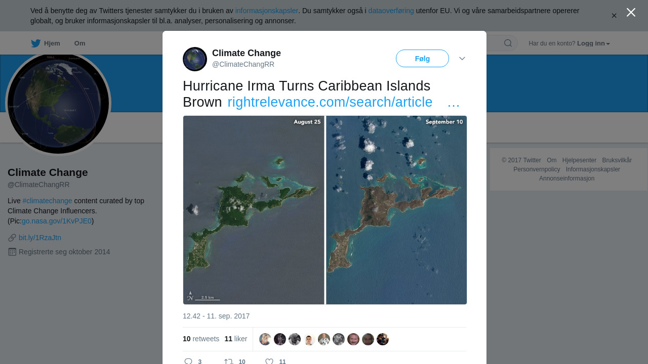
RT @ClimateChangRR: Hurricane Irma Turns Caribbean Islands Brown https://t.co/LhQzfmI5Ms https://t.co/n8J477qtmg
Postet:
2017-09-11 21:46:08
Delt innhold:
Hurricane Irma Turns Caribbean Islands Brown
earthobservatory.nasa.gov - Hurricane Irma churned across the Atlantic Ocean in September 2017, battering several Caribbean islands before moving on to the Florida Keys and the U.S. mainland. As the clouds cleared over places like the Virgin Islands, the destruction became obvious even from space. These natural-color images, captured by the Operational Land Imager (OLI) on the Landsat 8 satellite, show some of Irma’s effect on the U.S. and British Virgin Islands. The views were acquired on August 25 and September 10, before and after the storm passed. They are among the few relatively cloud-free images of the area so far.